East Java Sea Basin
Indonesia is believed to hold significant oil and gas reserves that remain to be discovered. Together with its active licensing round process, it is an attractive country for oil and gas exploration. There is plenty of running room in offshore Indonesia with numerous frontier basins and near-field exploration opportunities. Indonesia continues to draw investment from major energy companies, reinforcing its status as a key area for hydrocarbon exploration.
Why East Java?
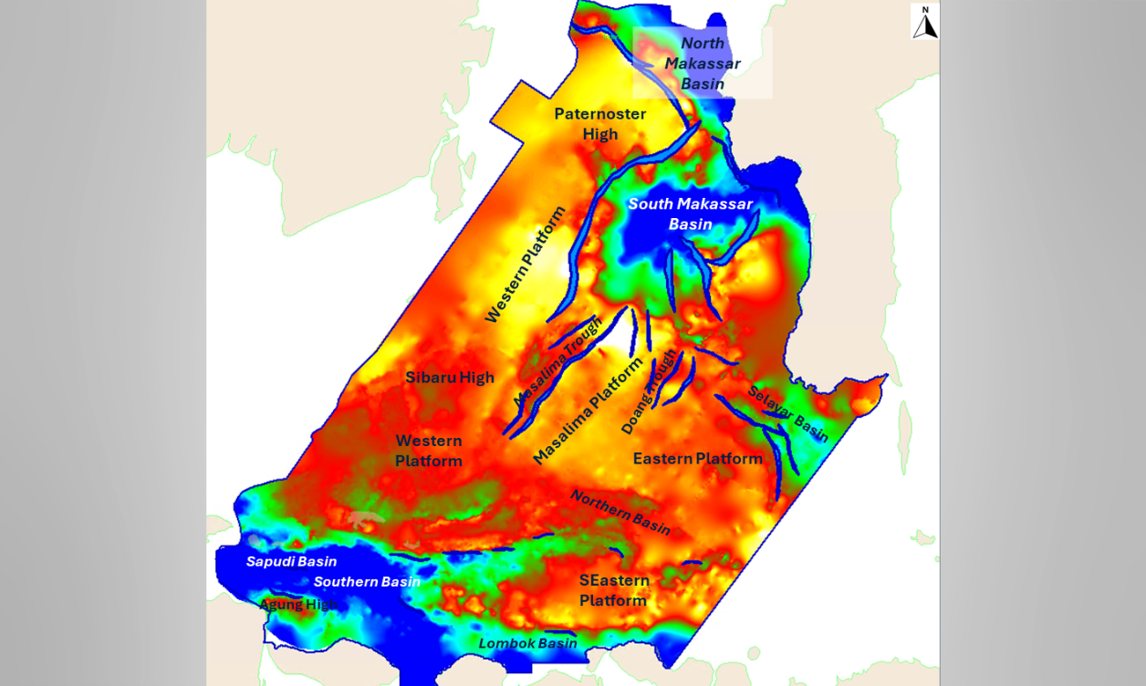
East Java region covers a wide area from the prolific back-arc Lombok Basin through to the Masalina Platform and into the South Makassar Basin. It is a Play diverse hydrocarbon exploration hotspot due to existing discoveries and infrastructure. The basin's sedimentary history, with significant carbonate and clastic deposits, coupled with complex Tertiary tectonics, has created ideal conditions for hydrocarbon generation and traps in various structural configuration. TGS’s recent datasets in this region have imaged clearly the deeper section, allowing to better understand the deeper Eocene Play.
%20-%20no%20border-1.png)
2Dcubed in East Java
The TGS East Java 2Dcubed project encompasses 3341 lines, with a total line length of 134,263km of existing 2D data across an area of more than 159,000 km sq. This dataset is unrivaled in its coverage, and it utilizes TGS’ proprietary 2Dcubed technology to create a single, conformable, easily accessible dataset designed to encourage and assist regional understanding and exploration in East Java.
This data will increase confidence in license-round decision-making processes and support further exploration, allowing fast regional interpretation over areas and blocks highlighted in the rounds. Additional acquisition in this area in 2024 is allowing continued development of this product.


East Java Facies Map Browser (FMB)
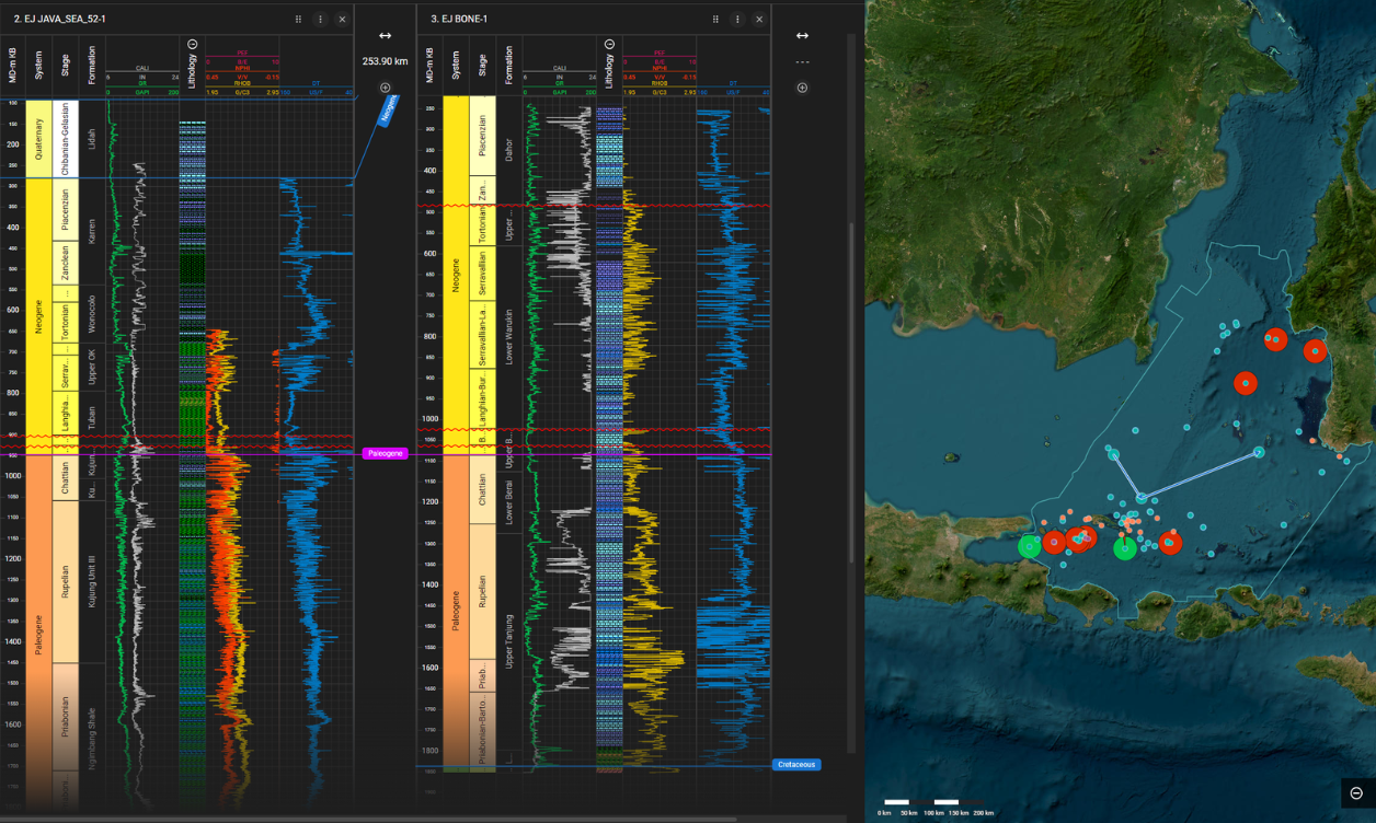
The extensive regional seismic data set in conjunction with the well data in the region allows for high-quality insightful interpretation products. Detailed well interpretation, including sequence, chronostratigraphic, and lithostratigraphic picks, as well as gross depositional environment (GDE) and facies, are part of the study.
With inputs derived from cutting descriptions, core, well correlations, seismic facies, and biostratigraphic reports. Specific attention was spent on the lithological interpretation, specifically variation and gradation within the dominant carbonates of the region, feeding into the wider depositional mode, building upon the hydrocarbon story that already exists.
Maps derived from the latest seismic data enable the generation of regional GDE maps that delineate the geological evolution and sedimentary history of the region, providing insights into the petroleum system at key intervals, but also has multiple applications for CCS, through overburden and potential aquifer distribution mapping. FMB well and map datasets are delivered via our easy-to-use desktop browser, allowing users to query and visualize interpreted wells, facies maps, and the stratigraphic framework.
Continued Exploration
Within the East Java region, TGS continues to invest heavily in support of the exploration and development efforts. 2024 saw numerous acquisition projects including South Kangean 2D and 3D and the regional acquisition in the East Java 2D cube area in the West Sulawesi 2D project. We continue to reprocess numerous datasets in the region and ensure that the regional database is kept ever-ready.
The data in East Java ties seamlessly with the Kutei 2D cubed product to the north allowing for mega-regional interpretation to make full use of available well data for best determination of exploration hotspots.

Speak to a Specialist
Interested in a product demo or trial? Let us know your needs and we’ll connect you to the right person or team.
Book a Data Viewing
Want to see the latest seismic data solutions and imaging technologies in your region of interest or for the next license round? Book a data viewing with one of our experts.
Discuss Your Seismic Data Needs
Every need is different and we'd like the opportunity to discuss yours further. Speak to one of our data or geoscience experts to customize seismic solutions specific to your requirements.

