East Coast India
Discover the energy potential of India’s East Coast. TGS is transforming offshore exploration with cutting-edge seismic reprocessing and advanced geological insights. With our proprietary 2Dcubed technology and Facies Map Browser, we are paving the way for smarter, data-driven energy discoveries in the region.
The Third Largest Energy Consumer
India is now the world's third-largest energy consumer and the fourth-largest importer of liquefied natural gas (LNG). Now India's government has set a target to raise the energy supply share of natural gas from the current 6.7% to 15% by 2030.
With significant estimated reserves of crude oil and natural gas and a government with a stated strategy to increase domestic energy production, offshore India presents excellent opportunities for E&P companies to invest in exploration and production, collaborate with the Indian government and contribute to the country’s energy goals.
TGS provides high-quality data and subsurface insight to support the Indian energy industry in achieving its objectives of energy affordability, reliability and environmental sustainability.

Conforming 2D/3D Seismic
for Regional Screening
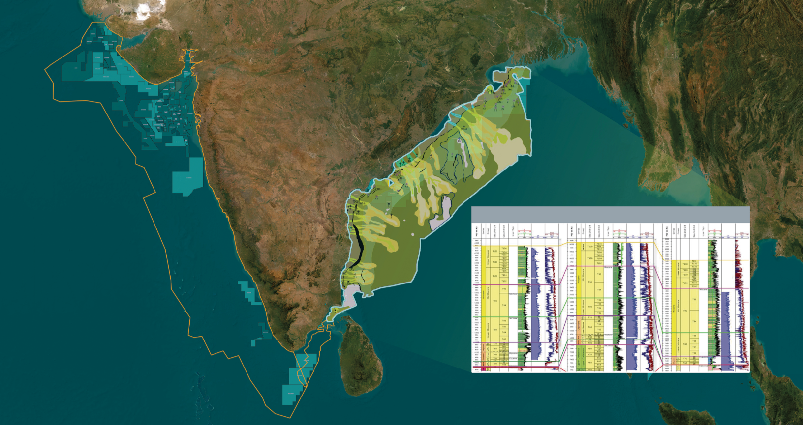
TGS provides subsurface insight to enhance exploration potential across Asia, offering seismic data coverage of the prospective Krishna-Godavari Basin, Cauvery Basin, and West Bengal Fan. This data will allow local and international companies to develop structural and geological models in their pre-study evaluation process to increase confidence in license-round decision-making processes and support further exploration.
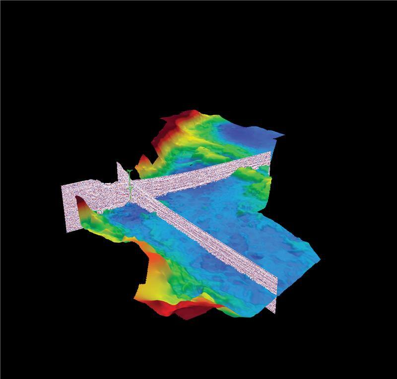
The specialist 2Dcubed technique applied by TGS offshore India utilizes unique technology to generate a 3D seismic migration volume from a set of 2D and 3D seismic lines. An advanced structurally conformable interpolation algorithm revitalizes existing 2D multi-vintage and 3D data. The resultant volume can be used for regional interpretation and optimizing subsequent seismic survey designs.
2Dcubed Data on India’s East Coast
The TGS East Coast India 2Dcubed project encompasses more than 250,000 line kilometers of existing 2D data across an area of more than half a million square kilometers offshore India’s east coast.
This dataset is unrivaled in its coverage, including the Krishna Godavari Basin, Cauvery Basin and West Bengal Fan, and it utilizes TGS’ proprietary 2Dcubed technology to create a single, conformable, easily accessible dataset designed to encourage and assist exploration endeavors offshore India. This data will increase confidence in license-round decision-making processes and support further exploration.


Best in Class Subsurface Data Interpretation
In addition to comprehensive seismic coverage, TGS also offers access to extensive well-based stratigraphic interpretation and sequence-constrained facies maps through the unique East Coast India Facies Map Browser (FMB). Current well data has been analyzed and interpreted using a developed sequence stratigraphic framework harmonized across the basins. Lithological and other log properties can be queried at various levels and displayed in table format or on maps for demonstrable purposes.
Detailed Gross Depositional Environment (GDE) maps are developed utilizing all available data including the seismic interpretation of the East India 2Dcubed dataset with geological understanding developed from well analysis, and the regional synthesis of the data.
FMB well and map datasets are delivered via our easy-to-use desktop browser, allowing users to query and visualize interpreted wells and facies maps and quick access to source data and a regional cross-border stratigraphic framework. This is the first phase of FMB development for the region. The TGS database and the FMB workflows will utilize a wealth of high-quality seismic data to enable a fast-track understanding of the regional geology and play fairways.
Krishna-Godavari Basin:
Mega 3D Reprocessing Project
Spanning 16,900 square kilometers of legacy 3D surveys, the KG Basin Mega 3D project will utilize cutting-edge broadband seismic reprocessing, including Pre-Stack Time Migration (PSTM), Pre-Stack Depth Migration (PSDM), and Full Waveform Inversion (FWI).
These advanced methods will ensure contiguous, high-resolution imaging, enabling detailed exploration of Tertiary stratigraphic plays and deeper synrift prospects. Commencing in January 2025, the project is expected to deliver final advanced seismic products by April 2026, with fast-track data available in Q2 2025.

Speak to a Specialist
Interested in a product demo or trial? Let us know your needs and we’ll connect you to the right person or team.
Book a Data Viewing
Want to see the latest seismic data solutions and imaging technologies in your region of interest or for the next license round? Book a data viewing with one of our experts.
Discuss Your Seismic Data Needs
Every need is different and we'd like the opportunity to discuss yours further. Speak to one of our data or geoscience experts to customize seismic solutions specific to your requirements.

