Australia
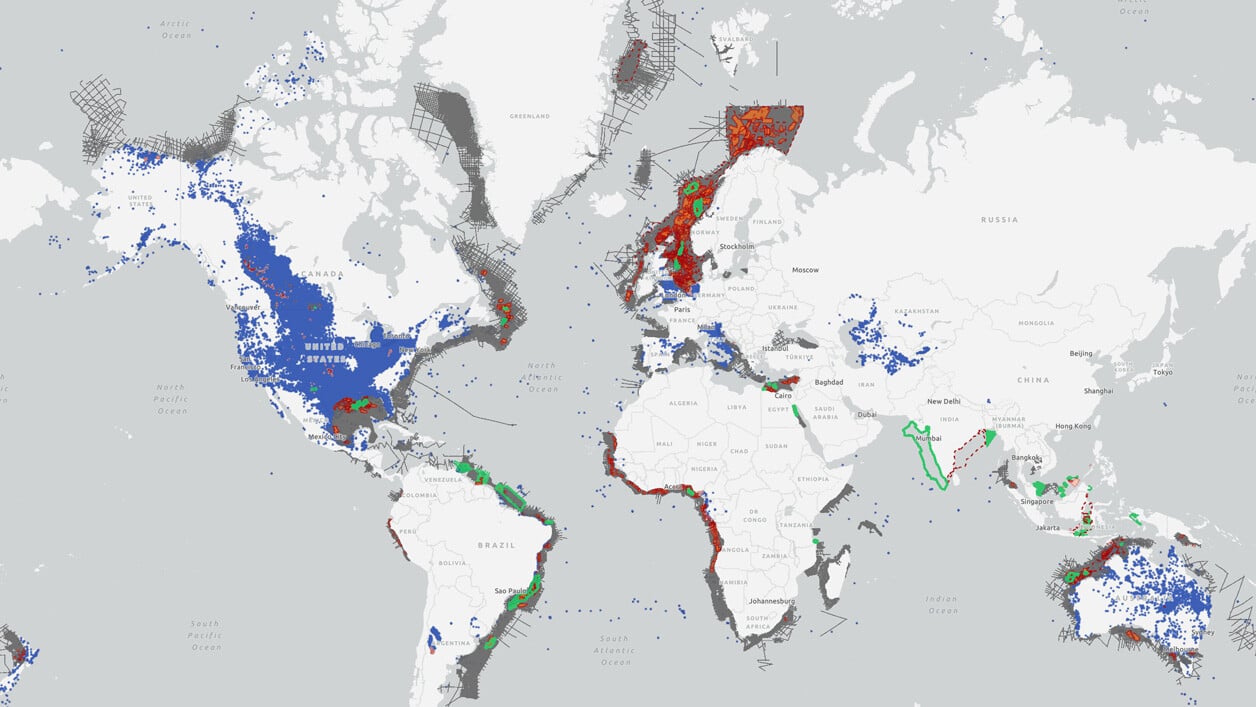
TGS has been active in Australia since 1998, building up an extensive database that consists of 2D, 2Dcubed and 3D seismic data, gravity and magnetics data, and Facies Map Browsers. Australia is an attractive investment location with abundant energy resources for exploration and development.
Our Data Coverage
Capreolus 3D
- Coverage includes the Dorado Oil Discovery
- 22,315 km2 3D multi-client seismic survey
- Phase 2 announced in 2022 (additional 4,500 km2)
- Located in Bedout & Beagle Sub Basins
Huzzas 3D
- Acreage Opportunities
- 2,200 km2 3D multi-client seismic data
- Reprocessed 2017-2020
- Coverage over the Barrow Sub-Basin
Northwest Shelf
- Vast 270,000 km2 2Dcubed (pseudo-3D) dataset
- Created using ‘structurally conformable interpolation’ to covert 2D data to 3D
- Reprocessed 2018-2020
- Regional Northwest Shelf coverage
Olympus 3D
- Coverage includes the Ironbark well
- 19,000 km2 3D multi-client seismic data
- Reprocessed 2017
- Located over the Carnarvon Basin
North Carnarvon 3D
- Acreage Opportunities
- 55,000 km2 3D multi-client seismic data
- Reprocessed 2017-2020
- Carnarvon Basin coverage
Otway 3D
- Acreage Opportunities
8,200 km2 3D multi-client seismic data - Reprocessed 2018-2019
- Otway Basin coverage
Papua New Guinea
- 47,217 km of 2D multi-client seismic data
- Coverage over the Gulf of Papua & Fly River Delta
- Reprocessed 2016
- Pre-Stack Depth Migrated (PSDM)
Cygnus 3D
- Acreage Opportunities
- 7,132 km2 3D multi-client seismic data
- Located in the Vulcan Sub-Basin
Capreolus 2
- Acquired in 2023
- 5,000 km2 3D multi-client seismic data
- Located in the Beagle Sub-Basin
Petrelex 3D
- 2,913 km2 3D multi-client seismic data
- Located in the Petrel Sub-Basin
Zenaide 3D
- Acreage Opportunities
- 3,123 km2 3D multi-client seismic data
- Located in the Petrel Sub-Basin
Data Library
Search our interactive map portal to see the industry-leading subsurface data we offer in Austrilia. View available data types, projects and deliverables in your areas of interest.
The 2023 Australia GHG Lease Round
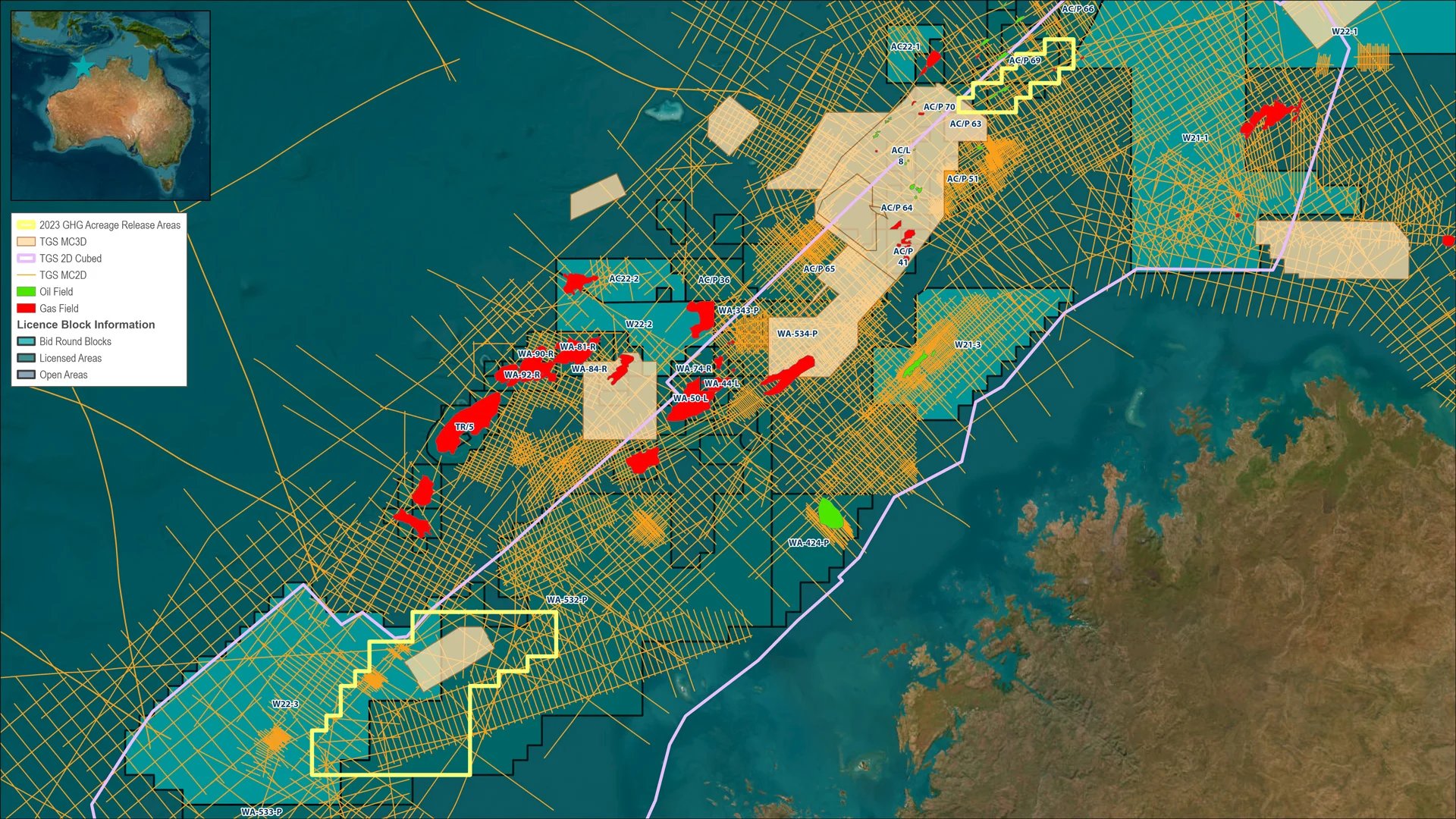
In Q3 of 2023, the Australian government announced an additional ten areas available for CO₂ storage exploration to potential bidders.
Before final submissions closed in Q4 of 2023 applicants were required to supply detailed assessments of the work they would be performing to determine their suitability. This included proposed engineering enhancements and environmental assessments as well as proposed strategies to conserve marine geography and ecology.
Asia Region
TGS has a wide range of planned and on-the-shelf seismic data across Asia, covering established hydrocarbon provinces in Malaysia as well as frontier basins in Timor-Leste and Indonesia.
Subsurface Interpretation
For the Geoscientist who needs regional subsurface knowledge, TGS’ multi-disciplinary Geoscience Interpretation group has consistently delivered best-in-class multi-client, basin-wide studies to the industry for over 20 years to reduce the risk, time and cost of the exploration-cycle.
