Jaan 3D (Offshore Northwest Africa)
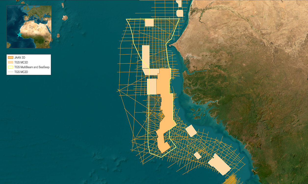
Jaan 3D combines several new seismic acquisition projects with reprocessed existing multi-client seismic, all fully pre-stack merged. New data was acquired using modern triple-source broadband acquisition. The final depth migrated volume covers over 28,300 km², capturing the paleo-shelf edge trend from shallow to deep.
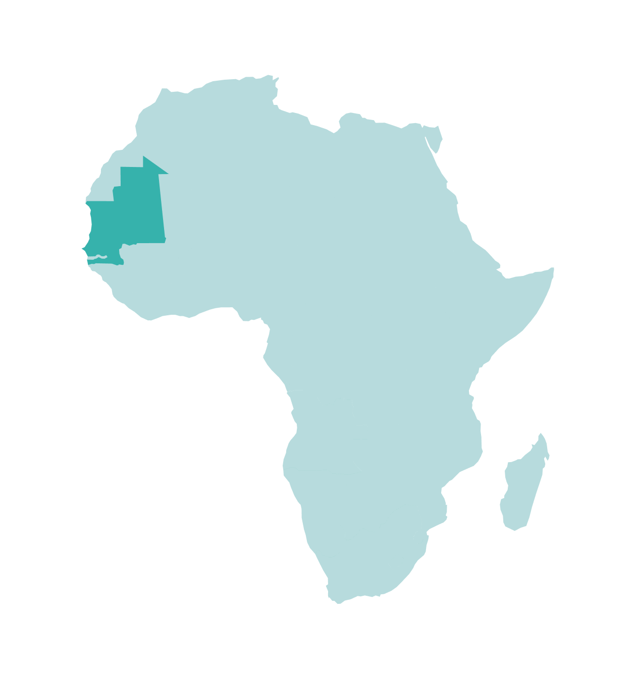
Revealing Africa's Most Successful Plays of Recent Times
With the GTA (Greater Tortue Ahmeyim) FLNG Phase 1 project due online in 2024, the North West African Margin remains a high-potential focus area for the industry. Successful negotiations and cross-border developments demonstrate that large projects can be successful in this area. Since the Fan and Sangomar (formerly SNE) oil fields were discovered in October 2014, exploration in the region has increased at a phenomenal rate, with discoveries at Yakaar and the GTA area, among others. Although these discoveries prove the working hydrocarbon system, key uncertainties and additional untested plays remain. Understanding the critical play components in this basin is important for explorers operating in the area. BP-Kosmos, operator of the Tortue discovery, directly attributed the company's success in this region to the vast 3D seismic projects that gave their geologists a holistic understanding of the complete petroleum system and hydrocarbon potential.
%20(1).png?width=2000&height=1041&name=BoothRight_MSGBCSLL_Dip07_GuB_Jaan3D_TVD_IL12266-VelModel%20(1)%20(1).png)
Dynamic Tomography Velocity Model Overlay on Broadband Reprocessed 3D Seismic Offshore Senegal
Learning from the giant discoveries and cross-border exploration success - while acknowledging the benefit that 3D seismic brought to BP-Kosmos - TGS created a new regional dataset in partnership with PGS and GeoPartners. The 28,000 km² Jaan 3D project has merged existing 3D data with new 3D acquisitions along the palaeo shelf-edge trend (PSET). The combined dataset has been processed and harmoniously merged to create a fully phased, amplitude, time and depth-migrated 3D exploration volume to unlock the next SNE-type discovery.
Data Library
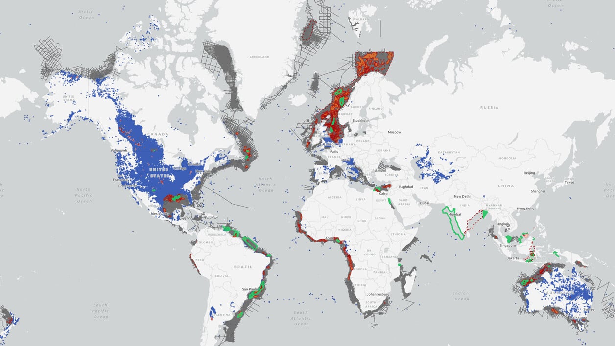
Search our interactive map portal to see the industry-leading subsurface data we offer in Jaan 3D. View available data types, projects and deliverables in your areas of interest.
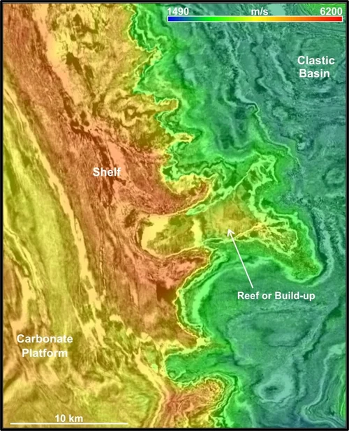
Targeted Depth Imaging Solution Reveals New Structure
The depth imaging workflow is based on layered tomography, which updates velocity in a top-down sequence. Geological models and interpretations are integrated into the tomography for an optimal estimate of the fine-tuned velocity models. The imaging workflow targets and builds on amplitude recovery and improves signal-to-noise ratio for stacking and depth migration algorithms. The resulting velocity model and depth imaging of the Jaan 3D demonstrates that the above-presented workflow applies to extensive 3D volumes. The Image on the right is a time slice from the Jaan 3D showing the results of a tomography model-building workflow, which incorporated geological information to refine the interval velocities.
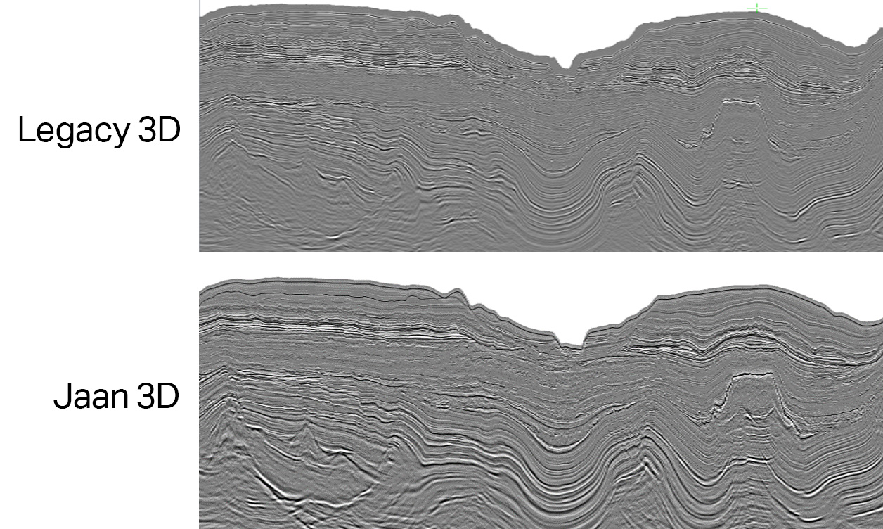
Seamless 3D Image
Our workflows allow the joining together of areas with different geological settings and multiple imaging targets, including those with challenging carbonate and salt structures. Hence, the quality of the continuous 3D image facilitates the mapping of potential Jurassic to Early Cretaceous source rocks beneath the carbonate shelf, which has, until now, been notoriously difficult. The images to the left show a seismic example comparing legacy 3D data with Jaan 3D in time.
MBSS and Prospectivity
An important step in the exploration cycle is to confirm the presence of hydrocarbons. The future integration of geochemical data with seismic mapping is needed to develop a more comprehensive model correlating source rocks, migration and charge of hydrocarbon (Sayers and Cooke 2018). Multibeam surveys efficiently map the seafloor and are cost-effective. Geochemical and biochemical information derived from the core samples serve as a crucial de-risking tool that can be utilized in modern exploration.
What is Jaan 3D?
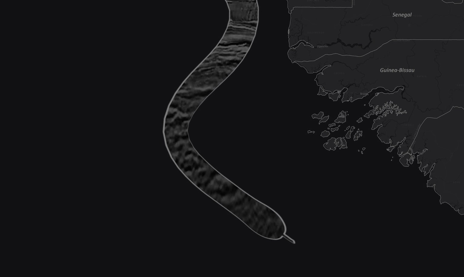
Jaan |ʤaːn|, translating to "Snake" in Wolof, one of the major dialects in NW Africa, is a fully harmonized 3D multi-client project. It covers the southern portion of the MSGBC Basin from northern Senegal, through The Gambia and the AGC zone, into Guinea-Bissau, and down to the Guinea transform fault. Jaan 3D brings together several new seismic acquisition projects - the first of which commenced towards the end of 2018 - as well as the reprocessing and full pre-stack merging of existing multi-client 3D.
The new data was acquired using modern triple source broadband acquisition and the final depth migrated volume covers over 28,300 km² capturing the complete paleo-shelf edge trend from shallow to deep. The trend and the coverage polygons appear as if they snake down the coastline, hence the name Jaan which means snake in local Wolof dialect.
Additional Resources
MSGBC Basin: An Integrated Approach to New Exploration
The Mauritania, Senegal, Gambia, Guinea-Bissau and Guinea Conakry (MSGBC) Basin is home to several recent high-profile oil and gas discoveries, both on and off the shelf. Discover how TGS is aiding the next steps in Northwest African exploration.
Discover Subsurface Data in the Region
Northwest Africa has been the shining light of African exploration. TGS offers 2D and 3D seismic in continuous coverage from MSGBC to Liberia, with supporting MBSS geochemistry, which continues to prove a working hydrocarbon system here.
Seismic Tomography to Enhance MSGBC Exploration
A study on the use of image-driven model building for ray tomography to increase confidence in exploring the MSGBC Basin.
Speak to a Specialist
Interested in a product demo or trial? Let us know your needs and we’ll connect you to the right person or team.
Book a Data Viewing
Want to see the latest seismic data solutions and imaging technologies in your region of interest or for the next license round? Book a data viewing with one of our experts.
Discuss Your Seismic Data Needs
Every need is different, and we'd like to discuss yours further. Please speak to one of our data or geoscience experts to customize seismic solutions specific to your requirements.

