

-
Offshore Energy
-
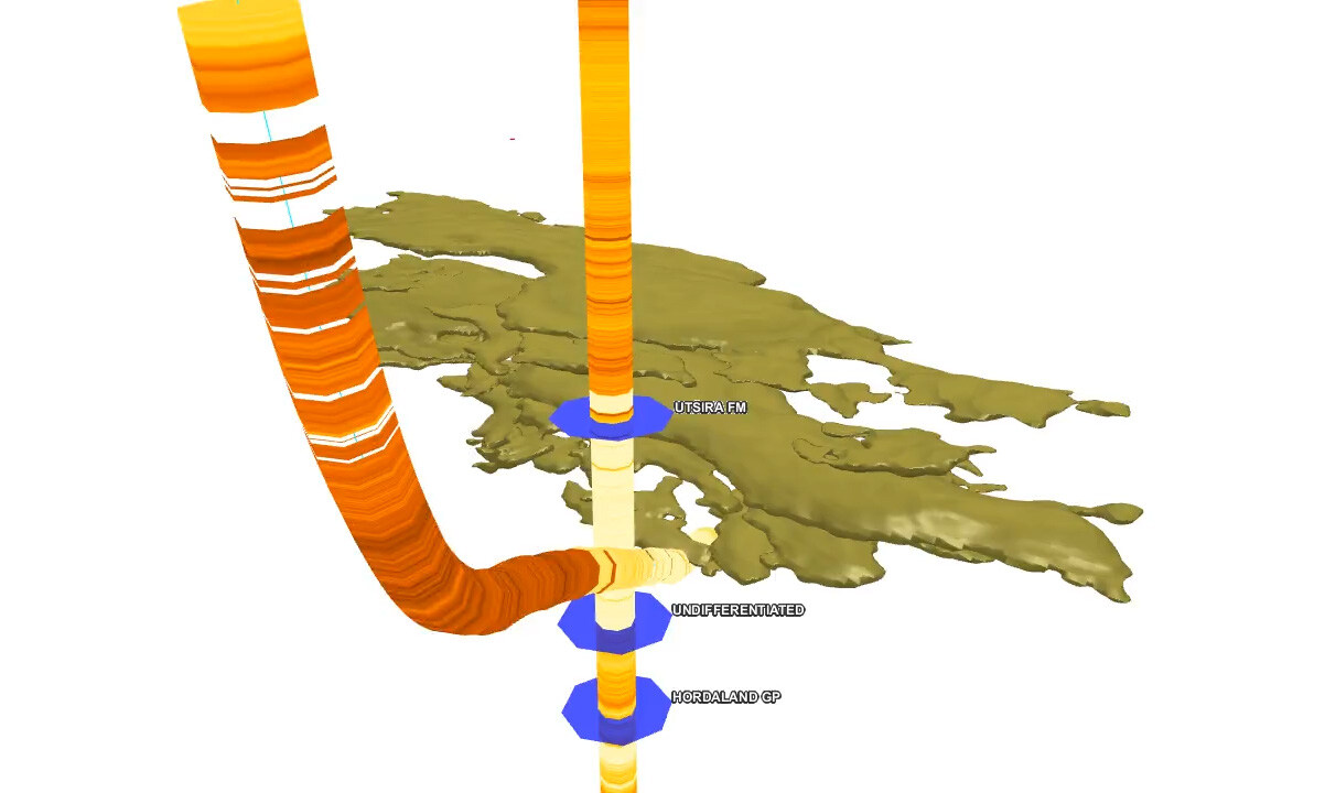
Carbon Storage
-
Offshore Wind
Offshore Energy

Offshore Energy
UHR3D benefits multiple offshore energy sectors, including hydrocarbon exploration and appraisal, wind farm development, and carbon storage. Using a wide-tow configuration with ultra-high-frequency sources, the technology delivers the detail needed to resolve complex geological features and reduce uncertainty in early-stage planning.
- Higher resolution, broader bandwidth, and improved signal-to-noise performance in ultra-shallow settings
- Detailed and accurate characterization of seabed and near-surface conditions
- Supports faster development timelines for offshore wind projects
- Enhances site assessment and risk mitigation strategies
- Reduces lead time and cost by minimizing the need for extensive geotechnical investigations
Carbon Storage
Carbon Storage
UHR3D provides a flexible, repeatable, and cost-effective solution for both initial site identification and long-term 4D seismic monitoring of carbon storage reservoirs. Its high spatial resolution supports early risk assessment and helps monitor containment integrity over time.
-
Designed to enable geophysical early phase 3D mapping and 4D monitoring of injected CO2
-
De-risk the overburden with enhanced imaging resolution
-
Pair with ocean bottom nodes (OBN) for velocity information
- Cost-efficient, consistent repeatability
Offshore Wind

Offshore Wind
Ultra-high-resolution 3D seismic delivers the subsurface clarity offshore wind developers need to de-risk turbine placement and optimize intra-array cable routing. UHR3D data helps identify buried hazards, variable soil conditions, and shallow geological complexity, supporting safer, more efficient design and installation.
- Reduce intrusive techniques such as boreholes
- Optimize wind farm engineering applications.
- Access ultra-high-resolution imagery. Less than 1 m vertical scale sub 100 meters depth
- Leverage geological expertise and the world’s largest subsurface data library with TGS

