Multi-Source Solutions
Solutions for Flexible Survey Geometries
Near-offset distribution becomes more uniform with wide-tow multi-source acquisition. The resolution and seismic image quality of shallow geology is correspondingly improved.
- Denser crossline spatial sampling enables higher frequency signals to be recorded for high-resolution broadband imaging.
- Wider source spreads can improve near-offset coverage without sacrificing survey efficiency. This is especially relevant for shallow-water areas with relatively shallow targets where good near-angle coverage is required for robust AVO analysis or for effective multiple removal.
- Wide-tow multi-source towing facilitates eSeismic surveys with low acoustic footprint.
Optimizing Seismic Imaging with Improved Near-Offset Distribution
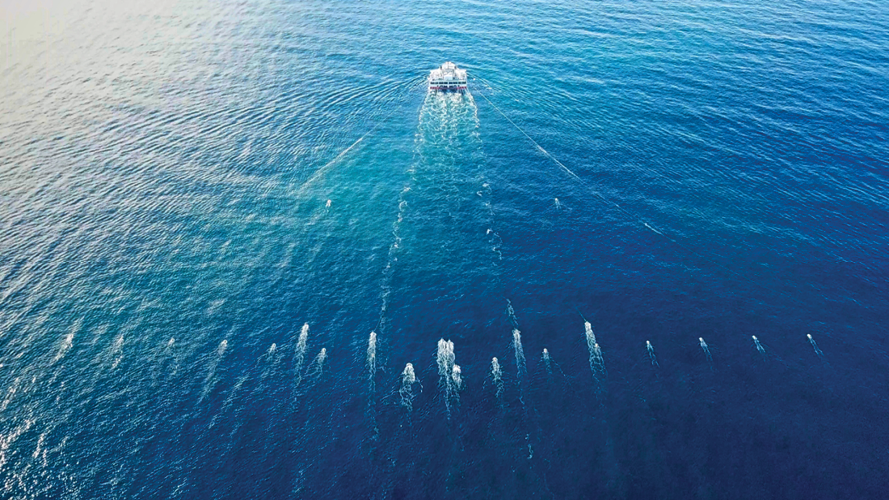
TGS can tow up to six source sub-arrays operating together. The sources can either be distributed laterally in the traditional manner with crossline positions between the two innermost streamers or in wide-tow mode where the sources are towed with much larger lateral separation. In both scenarios, increasing the number of towed sources will decrease the crossline separation between common midpoint (CMP) sublines, thereby improving the crossline spatial sampling of the emitted source wavefield. This will increase the high-frequency content of migrated seismic images.
A variation of multi-source shooting with a far lower acoustic footprint is eSeismic. Individual air guns are triggered randomly several times a second. Sub-arrays containing the air guns may be towed traditionally or in wide-tow source mode. eSeismic has the lowest sound emissions of any source concept and is suited to environmentally sensitive areas.
The illustration below compares the near-offset coverage resulting from a standard quad source and a wide-tow quad source. The streamer configuration (10 streamers with 50 m separation) and the sail-line separation (250 m) are identical in both examples. While the nearest offsets accumulate around the sail line locations for the standard quad source configuration, the wide-tow quad source enables a uniform distribution of the near offset traces in crossline direction. The improved near-offset coverage provides a good starting point for modern regularization/interpolation schemes to close the remaining gaps and allow more seamless imaging of the near-surface geology. The near offset sampling requirements depend on the geophysical imaging objectives, the complexity of the shallow surface, and the water depth.

Flexible Survey Geometries
Wide-tow multi-source is a common component of GeoStreamer X surveys that can deploy large GeoStreamer spreads for highly efficient acquisition, long streamer tails to assist deep velocity model building with Full Waveform Inversion (FWI), and source deployments to optimize shallow imaging resolution without contamination from traditional 'acquisition footprint' artifacts.
The figure below is an example from an area with traditional shallow seismic imaging challenges associated with glacial channels, gas pockets, and artifacts due to the rugosity of the chalk layers. The superior spatial sampling and near-offset coverage of the new data have contributed to substantial improvements in imaging resolution and clarity.
Similar wide-tow multi-source survey design principles can be applied to near-surface high-resolution 3D studies such as CCS site characterization, marine minerals exploration, or offshore wind farm site surveying. Near offset, long offset, and 3D spatial sampling requirements will depend on water depth and resolution requirements. As near-surface seismic or seabed mapping frequently requires the recording of seismic data with close-to-zero offset, the inline distance between sources and streamers can be minimized by moving the sources over the front end of the streamer spread. Ghost-free shallow broadband imaging is complemented by the broadband seismic imaging opportunities possible with multisensor GeoStreamer data.
Speak to a Specialist
Interested in a product demo or trial? Let us know your needs and we’ll connect you to the right person or team.
Book a Data Viewing
Want to see the latest seismic data solutions and imaging technologies in your region of interest or for the next license round? Book a data viewing with one of our experts.
Discuss Your Seismic Data Needs
Every need is different and we'd like the opportunity to discuss yours further. Speak to one of our data or geoscience experts to customize seismic solutions specific to your requirements.


