4D Survey Design
Subsurface Monitoring Requires Strict Design Thresholds
4D seismic monitoring of reservoir depletion, often assisted by enhanced recovery processes, relies upon the acquisition geometry being as close to identical as possible for all surveys used in the time lapse.
- Particular attention is given to how differences in position and depth of sources and receivers will translate into 4D signal errors
- The survey design is tailored to the likely thresholds achievable by the acquisition system
- Multisensor acquisition, source steering, streamer steering, and overlap streamers are best-practice for 4D
Optimizing 4D Acquisition Geometry for Subtle Reservoir Changes
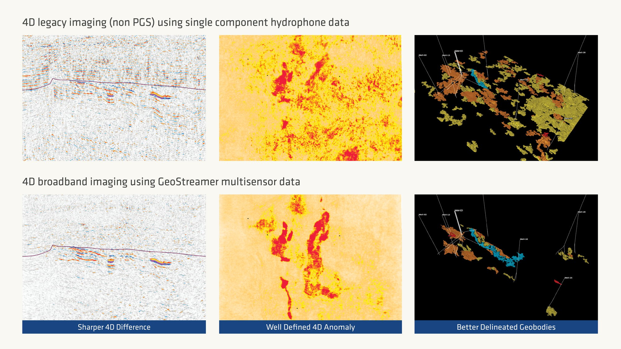
If all source and receiver positions are close to equal, differences in the recorded seismic wavefields due to non-repeated acquisition geometry will be negligible. Furthermore, insensitivity to local changes in receiver depth and/or sea-surface height between surveys will minimize non-repeatable time-shift differences. This is achievable with multi-sensor-on-multi-sensor 4D acquisition (see data comparison).
4D processing and characterization provide the best chance of extracting high-fidelity 4D seismic signals that can resolve subtle changes in reservoir saturation and pressure, and fluid movements can be accurately understood.

Calibrating Seismic Modeling with Reservoir Performance Data
An elastic seismic modeling exercise will determine preferred thresholds for errors in source and receiver position repeatability. This is typically conducted by the operators of an asset and calibrated with reservoir-simulation platforms to history matching of measured well performance. The technical specifications of the available acquisition platforms will also guide the modeling of acquisition parameter sensitivity vs. the ability to detect very small changes in seismic wavelet amplitude phase and/or timing.
In practice, the use of dense streamer spreads (e.g. 50 m streamer spacing) with additional overlap streamers used to contribute data when streamer feathering creates holes in offset classes (see illustration), is recommended to optimize the data available for 4D binning and data matching. When available, both source and receiver steering will minimize errors in positioning and repeatability (see real crossline error plot).
Speak to a Specialist
Interested in a product demo or trial? Let us know your needs and we’ll connect you to the right person or team.
Book a Data Viewing
Want to see the latest seismic data solutions and imaging technologies in your region of interest or for the next license round? Book a data viewing with one of our experts.
Discuss Your Seismic Data Needs
Every need is different and we'd like the opportunity to discuss yours further. Speak to one of our data or geoscience experts to customize seismic solutions specific to your requirements.


