Asker, Norway (7 July, 2009) - TGS continues their long-term commitment to resolve the geologic challenges and hydrocarbon potential of offshore Greenland with the commencement of the 2009 data acquisition season.
This season marks the 10th consecutive year of new data acquisition by TGS in Greenland. As in past years, the multifaceted acquisition campaign in 2009 will consist of seismic, aeromagnetic, and gravity data.
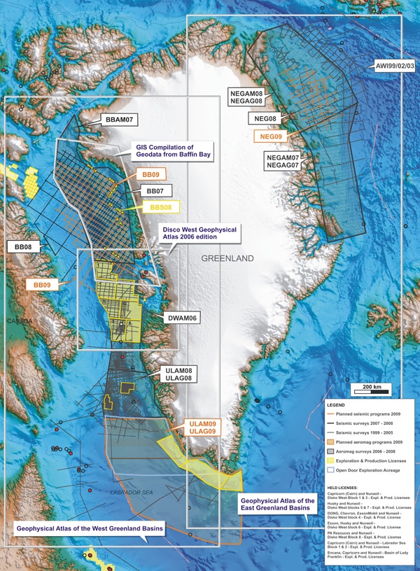
The first phase of data acquisition has already commenced and will result in more than 41,000 kilometers of aeromagnetic and gravity data being collected in the Ungava, Labrador region. This data will be processed by TGS and available to participating companies late in 2009.
TGS will soon commence the acquisition of 9,600 kilometers of 2D seismic data off the west coast of Greenland in the Baffin Bay. This new survey will infill previous TGS 2D programs to provide a continuous regional grid of data in the area. This seismic program has been designed to assist in the evaluation of the Baffin Bay area prior to a major bid round recently announced by the Greenland authorities to close in the spring of 2010.
"TGS continues to strongly believe in the hydrocarbon potential of Greenland." said Robert Hobbs, CEO of TGS. "Since 1999, our customers have supported TGS' focused and multi-year approach to provide the industry with the data necessary to evaluate this attractive frontier environment."
TGS owns the most complete and modern geoscientific data base in offshore Greenland, and upon completion of the 2009 season, TGS' library will include approximately 90,000 kilometers of 2D seismic data and 300,000 kilometers of aeromagnetic and gravity data in this area.
The TGS 2009 Greenland campaign is supported by industry pre-funding.


