
First Published: GEO ExPro, December 2017
Abstract
The tomography algorithm within TGS’s ImageZ™ depth-imaging software suite implements a tomography that involves intelligent interpolation and smoothing of a tomographic inversion update in order to accurately reflect underlying geological structure. Resulting velocity updates preserve edges observed within the stacked image, respecting visible faults and layering automatically.
High-resolution image-guided tomography (IGT) can be used to resolve the complex structure below a shallow trench in the Gulf of Mexico.
The Nessie project is a full-azimuth ocean-bottom node survey located in the ultra-shallow water of the South Timbalier trench area of the Gulf of Mexico, an area known for complex static problems. These are often addressed in the time domain by applying time shifts generated from a refraction statics solution. In the depth domain, however, the same time shift will produce kinematically incorrect depth migration results and can lead to velocity distortions during successive tomography-based model building.
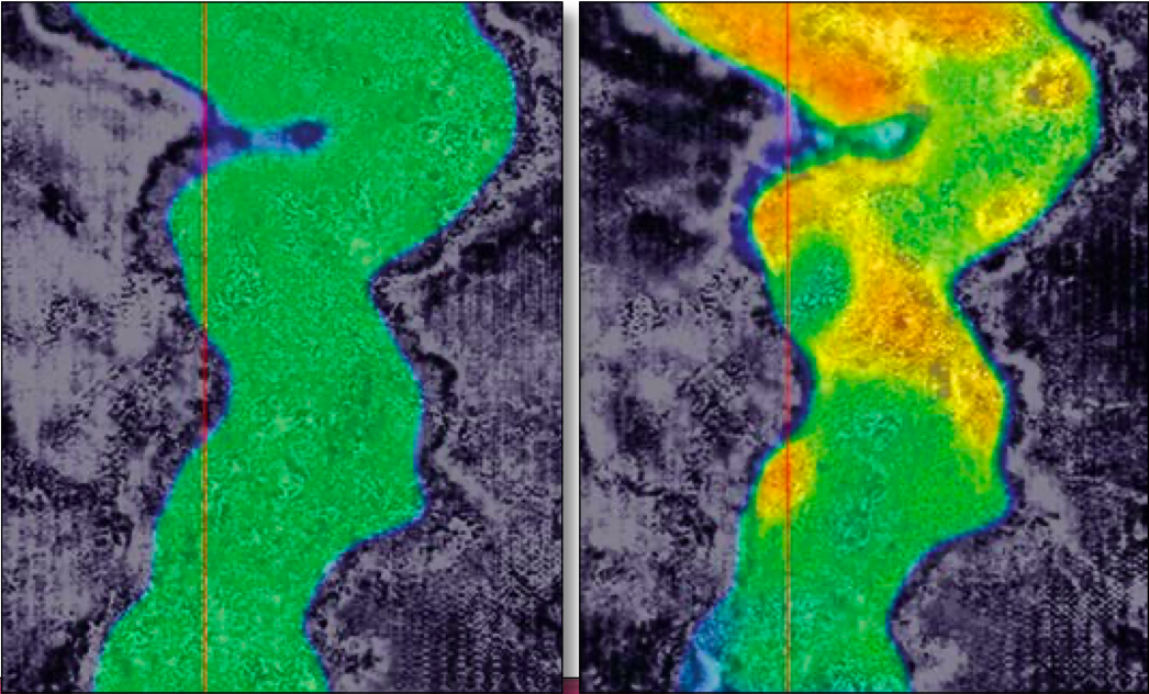
Figure: velocity variation in the trench before and after the high-resolution tomography.
The problem is instead addressed in the depth domain by high-resolution tomography. The high frequency nature of the surface consistent residual statics is difficult to resolve via tomographic inversion; therefore this portion of the statics is instead applied to the data prior to depth migration.
The final depth-imaging results demonstrate significant uplift, with accurate images, improved image focusing, correctly positioned steeply dipping events and better well-to-seismic ties. The improvements are due to proper well-to-seismic calibration, anisotropic parameter estimation and multi-azimuth tomographic inversion. Offset-dependent event picking and geologically constrained image-guided tomographic inversion further enhance the image quality.
Read the full article here.